Aerial Survey of the South Coaster wreck
Introduction
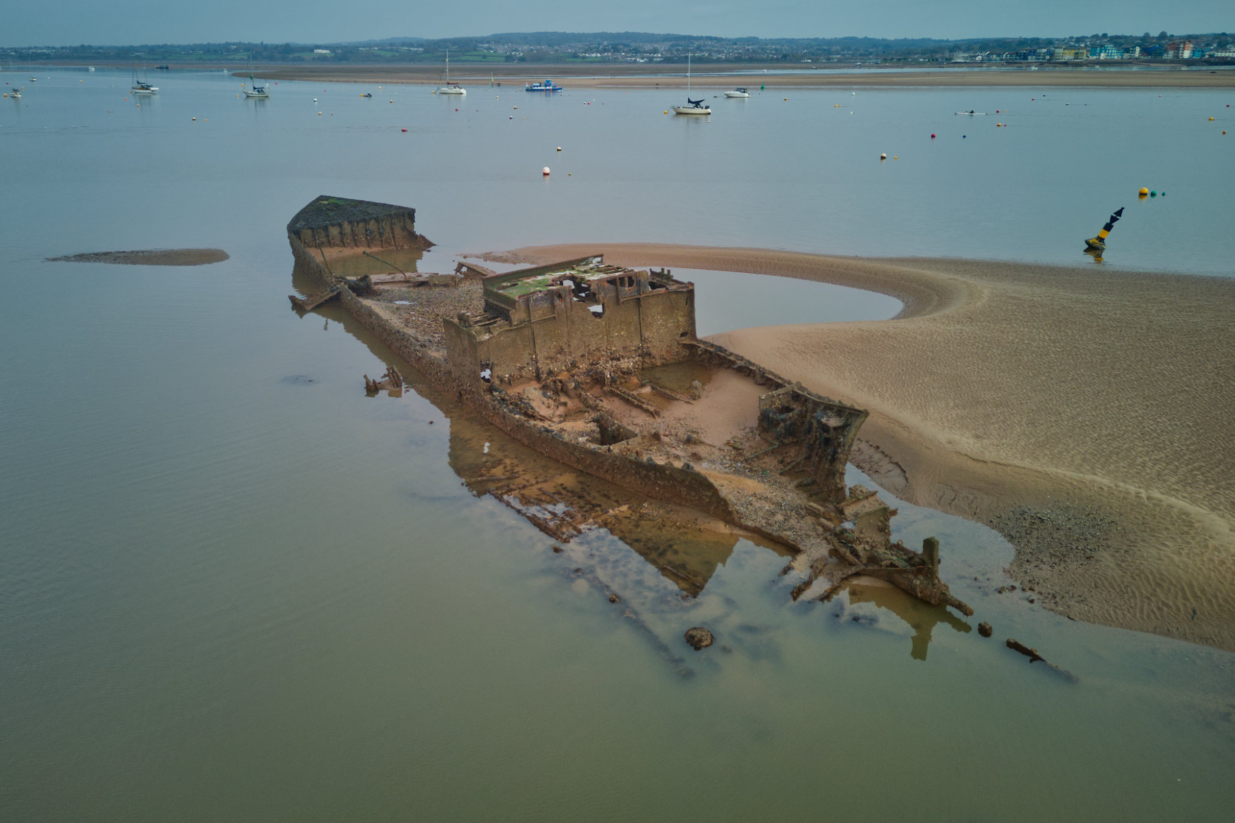
The South Coaster, originally named Oostvoorne, was built in 1916 by John Berg in Delfzijl, the Netherlands. The ship was renamed several times – first to Cwea, then to Martin – before it was finally given the name South Coaster. In December 1943, the South Coaster was chartered by the Admiralty to transport coal from Marsden to Exmouth. On the morning of 13 December, it ran aground on the east side of Pole Sands. Although there was initially no damage, the tugs sent by the navy were unable to free the ship. After a week, the weather worsened and a storm forced the crew to abandon ship with the help of the lifeboat. The storm loosened the ship and the Admiralty tugs managed to refloat it and ground it in its current position near the railway line. The damage caused by the storm was irreparable and the ship was eventually broken up for scrap.
https://www.submerged.co.uk/south-coaster
https://www.geograph.org.uk/photo/5860540
https://starcrosshistory.blogspot.com/2015/03/the-ss-south-coaster.html
Aerial Survey
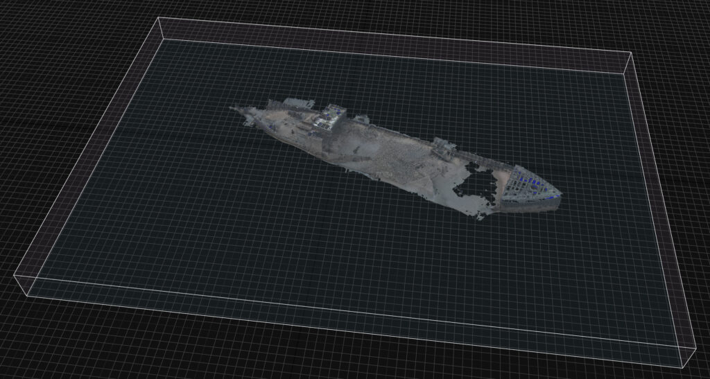
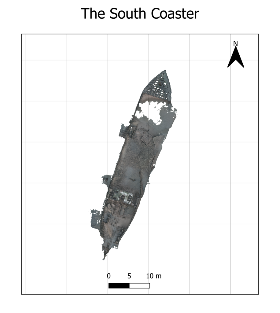
In this first phase of documenting the South Coaster shipwreck, I conducted initial tests using a DJI Mini Pro 3 drone. The survey primarily involved capturing aerial photographs, some of which are usable for photogrammetry. While the photos provide valuable initial data, working with the low sun angle, the water’s surface and the image quality of the drone posed challenges for creating accurate models and Orthomosaic images (see below). The reflective nature of the water and the low sun resulted in some inconsistencies in the data which are visible as holes (see below). However, these tests have provided useful insights, and I will share the preliminary results below.

Next Steps
The next stage of this project will involve waiting for optimal conditions to improve the quality of photos that may be used for photogrammetry. Specifically, I will be waiting for an overcast sky and low tide to ensure clearer images and better data capture. I plan to fly the drone in a grid pattern from a top-down perspective to capture orthographic details. Additionally, I will focus on several key points of interest, especially the vertical faces of the wreck which will be captured manually or by using the point of interest feature. If the tide is low enough, I may even walk over to the site and use a DSLR to document the lower areas for more detailed imagery.
Conclusion
Capturing aerial imagery is a vital first step in documenting the South Coaster shipwreck. By combining drone technology with advanced mapping techniques, I aim to preserve this maritime heritage site in a detailed and accessible way. While the initial tests have provided useful results, the challenges posed by water reflections and the low sun have made creating a complete orthomosaic and map difficult. The water surface, in particular, results in gaps and inaccuracies in the model. However, the next steps will focus on refining the data capture under more favourable conditions


